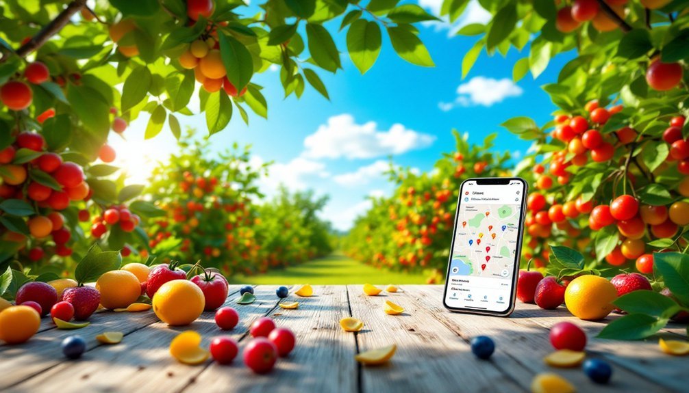
You'll find several robust fruit tree mapping apps to enhance your foraging adventures. Falling Fruit offers the largest database with 1.4 million locations across 111 countries, while Neighborhood Fruit fosters community-based harvesting. Urban Edibles guides city exploration, and regional options like Concrete Jungle (Atlanta) and Fruit Map LA provide localized resources. These apps combine GPS technology with user contributions to help you discover nearby free food while promoting sustainable practices. The digital foraging revolution awaits below.
Falling Fruit: The Global Leader in Urban Foraging Maps
While most people walk past urban fruit trees without a second glance, Falling Fruit has transformed these overlooked resources into an accessible feast.
Urban foraging turns city streets into nature's pantry, revealing free bounty hidden in plain sight.
This nonprofit organization has created an interactive global map featuring over 1.4 million locations for urban foraging across 111 countries.
You'll discover more than 3,000 types of edible plants through their platform, which uses Google Maps technology for easy navigation.
Whether you're searching for fruits, nuts, or mushrooms, Falling Fruit helps you locate food sources in public parks, streets, and even private properties (with permission).
The tree inventory continues to grow as users contribute new locations, with over 6,700 entries from public submissions.
Neighborhood Fruit: Connecting Communities Through Local Harvests
Unlike traditional mapping apps, Neighborhood Fruit transforms the way you connect with your local food landscape by fostering community relationships alongside foraging opportunities.
Building on Falling Fruit's extensive database of 3,000+ edible species, this platform encourages you to discover neighborhood trees you might otherwise overlook.
The app's strength lies in its community-driven approach, allowing you to both find and contribute to mapped local food sources.
When you locate fruit trees in your area, you'll join over 1.4 million mapped locations across 111 countries.
You're not just harvesting free produce; you're participating in a global movement that prevents waste and promotes sustainability.
Urban Edibles: Navigating City Landscapes for Wild Food
Urban environments teem with overlooked wild food sources waiting to be discovered by savvy foragers. The Urban Edibles mobile app transforms your city exploration into delicious adventures by mapping fruit trees and edible plants hidden in plain sight.
You'll gain access to over 1.4 million foraging locations through platforms like Falling Fruit, where community contributions and municipal data merge to create extensive resource maps.
| Season | Common Finds | Foraging Benefits |
|---|---|---|
| Spring | Elderflowers | Connection to nature |
| Summer | Wild plums | Free nutritious food |
| Fall | Apple trees | Reduced food waste |
| Winter | Nuts | Environmental awareness |
These interactive maps provide harvest timing information and species details, helping you reconnect with food origins while encouraging sustainable urban landscapes that prioritize edible plantings.
Concrete Jungle: Mapping Atlanta's Overlooked Fruit Resources
Thousands of fruit trees dot Atlanta's landscape, yet they've remained largely invisible to residents until Concrete Jungle stepped in.
This innovative initiative has mapped over 1,000 fruit trees throughout the city, creating an accessible digital resource for urban foragers seeking free, fresh food.
You can use their app to locate everything from figs to plums to peaches growing in your neighborhood.
Beyond just finding fruit, you're invited to contribute by adding new tree locations to the map, strengthening community connections around these shared resources.
Fruit Map LA: Southern California's Comprehensive Foraging Guide
Southern California's fruit trees extend far beyond private backyards, and Fruit Map LA has revolutionized how locals access this bounty. This detailed foraging guide provides a thorough map of publicly accessible fruit trees and edible plants throughout the region.
You'll find everything from citrus and stone fruits to nuts on this specialized platform. Navigation is simple—just open the app to locate the nearest harvestable trees, complete with information about species and ideal harvesting seasons.
Fruit Map LA encourages community participation by allowing you to report new tree discoveries and share your foraging experiences.
Beyond just finding free produce, the app promotes sustainable foraging practices that reduce urban food waste. By connecting you with abundant fruit resources growing in public spaces, it transforms how you interact with Southern California's edible landscape.
Wild Food Map: Seasonal Tracking of Edible Urban Plants
You'll find the Wild Food Map's seasonal foraging guide invaluable when planning your urban harvesting schedule throughout the year.
Its interactive geographic filtering allows you to narrow down edible plants by neighborhood, species, or ripeness status with just a few taps.
The community-driven platform thrives on user harvest updates, ensuring you'll always know when those neighborhood plums are perfectly ripe or which mushroom patches are currently productive.
Seasonal Foraging Guide
When planning your urban foraging adventures, Falling Fruit's Seasonal Foraging Guide becomes an indispensable tool for timing your harvests perfectly.
You'll access detailed information on over 3,000 edible plants, learning precisely when apples, plums, elderberries and other urban treasures reach peak ripeness.
The guide's user-friendly interface visually displays seasonal availability, making it easy to plan harvesting trips throughout the year.
You'll enhance your foraging success as you gain insights into local ecosystems and understand the natural cycles of neighborhood plants.
What makes this resource particularly valuable is its community-driven knowledge system.
You can contribute your own seasonal observations, creating a dynamic, real-time database that benefits all foragers.
This collaborative approach guarantees the guide stays current with changing climate patterns and local growing conditions.
Interactive Geographic Filtering
Building on the seasonal knowledge base, Falling Fruit's interactive map transforms how you locate edible urban plants in your area.
You'll find precise foraging locations for over 2,300 types of edible plants mapped across 1.3 million sites, all filterable by geographic area and seasonal availability.
The app's Google Maps integration provides intuitive navigation to your desired harvest spots, complete with timing recommendations for ideal picking.
What makes this tool especially valuable is the community engagement aspect—contributors regularly update plant conditions and seasonal shifts in real-time, ensuring you're working with current information.
You can join this collaborative effort by reporting your own findings and sharing local edible resource information.
This collective knowledge creates a dynamic database that adapts to seasonal changes and helps fellow foragers discover accessible urban harvests.
Community Harvest Updates
While traditional foraging relies on personal knowledge and guesswork, Wild Food Map revolutionizes the experience by creating a living database of urban edibles.
You'll find real-time community harvest updates on over 3,000 different edible plants, from fruits and nuts to edible flowers.
The app's collaborative approach lets you both benefit from and contribute to this dynamic resource. When you locate a fruit tree, you can share updates about its ripeness and availability, helping fellow foragers plan successful outings.
With 1.4 million mapped locations, you're never far from seasonal bounty in urban areas, parks, and neighborhoods.
These community-driven updates transform scattered knowledge into organized data, ensuring you know exactly when to harvest specific edibles in your region for maximum yield.
Frequently Asked Questions
How Do I Forage in My Area?
You can forage in your area by using the Falling Fruit app to find mapped food sources. Check their database of 1.4+ million locations showing fruit trees and edible plants near you. Report your discoveries too!
What Is the Falling Fruit App?
Falling Fruit is an app that shows you over 1.4 million locations worldwide for foraging edible plants. You'll find fruits, nuts, and more on its interactive map that you can also contribute to.
How to Catch Falling Fruit?
To catch falling fruit, you'll need a fruit picker tool or net basket with an extendable pole. Alternatively, spread tarps under trees before gently shaking branches. Always wear gloves and protective headgear when harvesting.
What Is the New Zealand Fruit and Food Share Map?
It's an interactive platform where you'll find public and private fruit trees across New Zealand. You can locate free produce, add your own trees, and connect with other foragers to reduce food waste.
In Summary
You'll find these apps transform your urban environment into a produce aisle waiting to be explored. Whether you're tracking seasonal changes with Wild Food Map or connecting with neighbors through Neighborhood Fruit, they're putting free food literally at your fingertips. Download one today and you'll never look at city trees the same way again—your next free, sustainable meal is just a tap away.


Leave a Reply