
Empty lots are urban foraging hotspots for wild edibles like dandelion, plantain, and lambs quarters. You'll find greater biodiversity in these unmanaged spaces compared to manicured parks. To create your own foraging map, use smartphone apps with GPS tracking and mark seasonal availability with color coding. Always identify plants carefully using reliable field guides and avoid areas with potential contamination from traffic or industrial runoff. Ethical harvesting practices guarantee sustainability for both wildlife and your community's future foraging adventures.
Mapping Wild Edibles: Spot Plants in Empty Lots
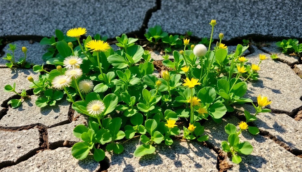
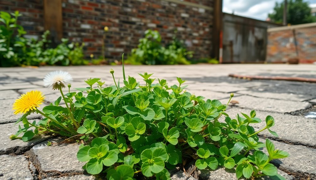
While many overlook empty lots as mere vacant spaces, these urban gaps actually serve as thriving habitats for numerous wild edibles. Disturbed soil in these locations creates perfect conditions for nutrient-rich plants like dandelion, plantain, and lambs quarters to flourish.
You can contribute to community food knowledge by documenting these unexpected food sources. Using platforms like Falling Fruit Map, you'll help others discover local foraging opportunities while reducing dependence on store-bought produce.
Regular visits to these lots throughout the seasons will reveal different wild edibles as they emerge and mature.
Remember to practice ethical foraging by harvesting only what you need and leaving sufficient plants behind. This guarantees these urban ecosystems remain sustainable food sources for both wildlife and fellow community members.
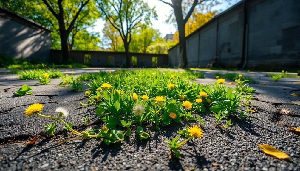
Why Empty Lots Are Urban Foraging Goldmines
You'll find empty lots burst with biodiversity that flourishes without human intervention, creating natural urban foraging goldmines.
These overlooked spaces offer seasonal harvesting opportunities throughout the year, from spring greens to fall fruits and nuts.
Urban soil conditions, often rich with nutrients from years of accumulated organic matter, support surprisingly robust edible plant communities that adapt perfectly to city environments.
Biodiversity Thrives Unmanaged
As cities expand with concrete and development, empty lots emerge as unexpected sanctuaries for wild edibles.
These urban green spaces, free from human intervention, create perfect conditions for biodiversity to flourish naturally. Without the disruption of landscaping or pesticides, wild food varieties establish thriving communities.
What makes these unmanaged spaces special:
- Plant diversity increases as native and introduced species compete and coexist.
- Minimal human disturbance allows edible plants to complete their full growth cycles.
- Seasonal succession creates year-round foraging opportunities.
- Ecological resilience develops through complex plant relationships.
You'll discover that these overlooked patches of land support more edible species than manicured parks.
Their unstructured nature mirrors natural ecosystems, creating microcosms of wilderness where dandelions, purslane, and dozens of other edibles await your discovery.
Seasonal Harvest Opportunities
Throughout the year, empty lots transform into seasonal treasure troves for urban foragers seeking fresh, wild foods.
Spring brings the first flush of tender greens like dandelion and plantain, offering nutrient-dense additions to your meals when grocery produce might lack flavor.
As summer unfolds, you'll discover lambs quarters and other heat-loving wild edibles reaching their peak.
These untended spaces provide ideal foraging locations without the competition you'd face in more popular parks and green spaces.
Abundant Urban Nutrients
Empty lots serve as unexpected nutritional powerhouses in our urban landscapes. These overlooked spaces often harbor diverse edible plants that thrive without human intervention, creating perfect foraging opportunities right in your neighborhood.
When you explore these urban oases, you'll discover:
- Rich biodiversity – dandelions, plantains, and garlic mustard flourish in these less disturbed environments.
- Cleaner foraging – reduced traffic and fewer disturbances mean safer, untainted wild foods.
- Abundant harvests – minimal maintenance allows edible plants to grow densely and reproduce freely.
- Sustainable nutrition – zero food miles when you gather plants within walking distance of home.
These forgotten corners showcase nature's resilience and offer a glimpse into how urban rewilding can transform city spaces into productive food landscapes while supporting ecological diversity.
Essential Tools for Creating Your Neighborhood Foraging Map
Creating your neighborhood foraging map requires specialized tools that'll transform casual walks into productive harvests.
You'll need a smartphone app with GPS tracking to mark fruit trees and wild edibles, colorful markers to indicate seasonal availability on printed maps, and a contamination alert system to flag areas with potential pollution or pesticide use.
These practical tools help you not only document nature's pantry but also guarantee safe, sustainable foraging throughout the year.
Tech for Tracking Trees
While foraging enthusiasts once relied on hand-drawn maps and memory to locate wild edibles, today's technology offers powerful tools to create detailed, shareable foraging maps.
Platforms like Fallen Fruit let you contribute to interactive map databases where communities document neighborhood resources collectively.
To maximize your tracking efficiency:
- Download smartphone apps that geotag foraging locations—take photos and add notes about ripening times
- Use GPS tools to mark precise coordinates of fruit trees and perennial edibles
- Join local initiatives like Brisbane Feral Fruit Map to tap into existing knowledge
- Schedule regular map updates to reflect seasonal availability
Seasonal Harvest Markers
Because successful foraging depends heavily on timing, seasonal harvest markers serve as critical signposts for your neighborhood food map. Early spring blossoms on fruit trees provide perfect indicators for future harvesting spots—capture these locations now for summer bounty later.
Update your map regularly as different wild edibles reach their prime at varying times. You'll maximize your harvests by tracking these seasonal changes.
Consider using a printed Google Map with color coding and symbols to enhance detail and readability of your paper wild food map.
Resources like Falling Fruit and local mapping initiatives can supplement your personal observations with community knowledge.
Contamination Alert Systems
As you develop your seasonal map of neighborhood treasures, safety must take center stage in your foraging practice. Contamination alert systems are essential components of any urban foraging map, helping you avoid potentially hazardous areas affected by traffic pollution and dog waste.
Your collaborative map should include:
- High-risk indicators for areas near busy roads where exhaust particles settle on plants
- Markers for dog-friendly parks where pet contamination is likely
- Color-coded zones reflecting contamination severity based on community reports
- Date stamps showing when contamination data was last updated
Encourage fellow foragers to report new contamination concerns they observe.
This community vigilance guarantees everyone has access to current safety information, making your neighborhood map a truly valuable resource for responsible wild food gathering.
Identifying Common Edible Plants in Vacant Urban Spaces
Urban environments, often overlooked as food sources, actually teem with edible plants hiding in plain sight. In vacant lots throughout your city, you'll find wild edibles like dandelion, plantain, and garlic mustard waiting to be discovered and enjoyed.
Before you forage in urban spaces, arm yourself with reliable identification resources like Peterson Field Guides. Learning to recognize these common species guarantees both safety and success when harvesting.
Remember to check plants carefully, as urban environments can harbor pollutants that contaminate vegetation.
As you develop your identification skills, consider contributing to community mapping initiatives that document abundant foraging locations. This sharing of knowledge not only builds local food resilience but also deepens your connection to the urban ecosystem while reducing food miles.
Seasonal Mapping Strategies: When to Scout and Harvest
Successful foraging depends largely on timing your scouting expeditions strategically throughout the year.
Early spring provides the perfect opportunity to locate fruit trees when their blossoms make them highly visible in the urban landscape. As you build your foraging map, you'll enhance your land use knowledge for later harvests.
- Scout during early spring to identify blossoming fruit trees and mark them on your map
- Update your maps regularly as different species ripen at various times
- Return to mapped locations in summer when fruits are ready for harvest
- Track seasonal patterns to determine ideal harvesting windows for sustainability
Addressing Contamination Concerns in Urban Foraging Areas
While identifying abundant wild edibles represents half the foraging battle, ensuring their safety for consumption remains equally critical. You'll need to evaluate potential contamination risks when mapping your urban harvest spots.
| Contamination Source | Risk Level | Best Practices | Safe Alternatives |
|---|---|---|---|
| Traffic Pollution | High | Avoid roadside plants | Focus on elevated woody species |
| Dog Activity | Medium | Harvest above "leg-lifting" height | Seek managed areas with restrictions |
| Invasive Species | Variable | Research local toxicity concerns | Many invasives are safe and abundant |
| Industrial Runoff | High | Check proximity to water wells | Choose uphill locations away from drainage |
Interestingly, foraging from woody plants like trees and shrubs typically presents lower contamination risk than ground-level herbs. When mapping potential sites, prioritize less intensively managed green spaces where native plants thrive but access concerns are addressed.
Building a Community Foraging Database With Digital Tools
Once you've identified safe foraging locations, sharing this knowledge with others can multiply its value exponentially. Tools like Falling Fruit and Google My Maps let you create detailed databases that pinpoint wild edibles in your area.
Creating an effective foraging map requires:
Effective foraging maps demand consistent updates, detailed plant information, community participation, and ethical harvesting guidelines.
- Regular updates on fruit ripeness and seasonal availability
- Detailed entries about plant types and harvesting seasons
- Community engagement through workshops and online sharing
- Documentation of ethical foraging practices
You'll find that maintaining a digital database becomes easier as more contributors join your effort.
When community members collaborate on mapping projects, everyone gains better access to local food sources. The map becomes a living document that reflects seasonal changes and new discoveries, transforming individual knowledge into a valuable shared resource.
Ethical Considerations for Harvesting From Vacant Properties
Before venturing onto vacant properties for foraging, you'll need to navigate several ethical considerations to guarantee your harvesting remains both legal and sustainable. Always obtain permission from property owners, even if lots appear abandoned. This protects you legally and builds community trust.
Be cautious about plant species growing near city streets or industrial zones, as they may contain harmful contaminants. Take only what you need, leaving sufficient plants to regenerate and maintain ecosystem balance.
| Ethical Concern | Why It Matters | Your Action |
|---|---|---|
| Permission | Legal protection | Contact owners first |
| Contamination | Health safety | Test soil, avoid busy roads |
| Sustainability | Ecological balance | Harvest sparingly, reseed |
Familiarize yourself with local regulations before foraging, as rules vary by location. Sharing your knowledge with others creates a more responsible foraging community that respects both land and landowners.
Frequently Asked Questions
How to Find Edible Plants in the Wild?
To find edible plants in the wild, you'll need to research local species, use reliable field guides for identification, look during peak seasons, and join foraging communities to learn proper techniques and locations.
What Are the 9 Rules to Follow When Finding Edible Plants?
When finding edible plants, you'll need to: identify with certainty, learn one plant first, use regional guides, avoid polluted areas, forage ethically, harvest sustainably, respect private property, check local regulations, and never taste-test unknown plants.
What to Avoid When Foraging?
When foraging, avoid areas with pollution, traffic, or pet waste. Don't harvest without knowing local regulations. Never eat plants you can't confidently identify, and don't overharvest—this guarantees sustainability and your safety.
How to Find Out if a Plant Is Edible?
To determine if a plant is edible, you'll need to consult reliable field guides, use plant identification apps, cross-reference multiple sources, join local foraging groups, and never eat anything you're not 100% certain about.
In Summary
You've taken your first steps into urban foraging by mapping your neighborhood's wild edibles. Remember, it's not just about finding free food—you're reconnecting with nature, building community resilience, and developing valuable skills. As you continue to map and harvest responsibly, you'll discover that these overlooked empty lots offer incredible abundance right where you live. Happy foraging!


Leave a Reply