Mapping your neighborhood's fruit trees reveals fresh produce while supporting local food security. You'll use smartphone apps to document locations, varieties, and harvest times of public and private fruit sources. By joining our volunteer network, you'll learn tree identification, gain mapping skills, and connect with like-minded neighbors passionate about sustainable foraging. Your contributions help reduce food waste and build stronger community relationships. Discover how a simple afternoon of tree spotting can transform your neighborhood's food landscape.
Why Mapping Neighborhood Fruit Trees Matters
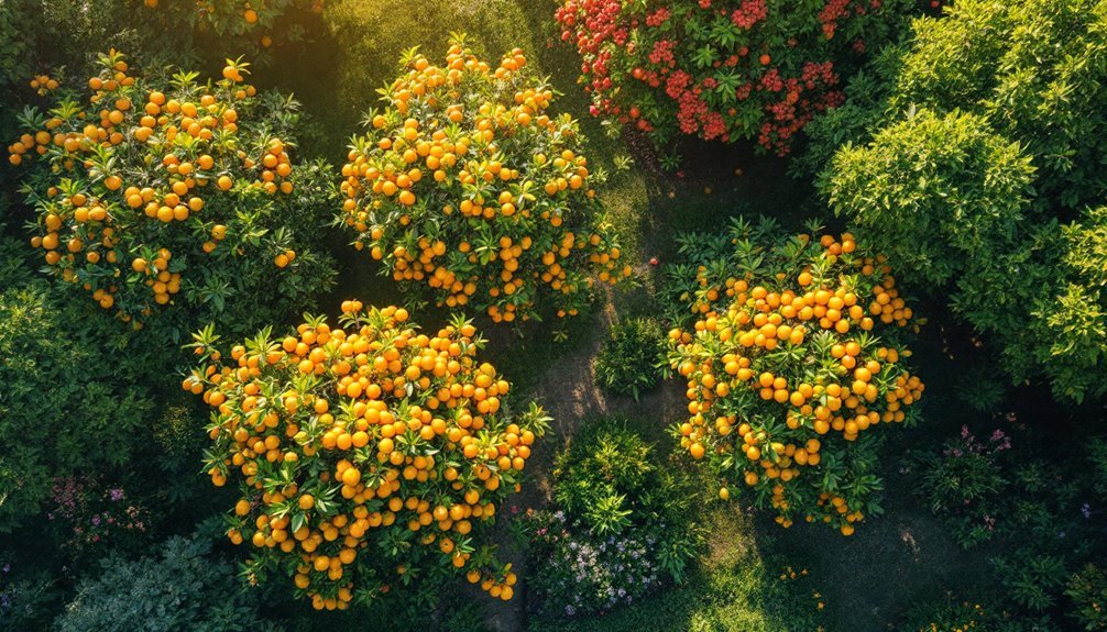
While many urban residents search grocery stores for fresh produce, an abundance of fruit often hangs untouched on trees throughout their neighborhoods.
You're living amid overlooked food sources that could reduce food deserts and provide nutritious options to your community.
When you help document local fruit trees, you're creating valuable awareness about edible resources in your area.
If you're interested in volunteering, you'll connect with neighbors while promoting sustainable foraging practices and urban biodiversity.
As a tree enthusiast, your contributions highlight these natural assets and prevent food waste by directing people to seasonal bounty they might otherwise miss.
The environmental benefits extend beyond food access, supporting local ecosystems.
Please contact us to join this important initiative that transforms how communities view and utilize their shared natural resources.
Getting Started as a Tree Mapping Volunteer
Once you've decided to join the fruit tree mapping movement, getting started is straightforward and rewarding. Please sign up through our volunteer registration form by providing your name, email, and preferred mapping date. You'll receive a confirmation email with details about upcoming training sessions with Trees For Houston.
| What You'll Gain | What You'll Contribute |
|---|---|
| New skills | Food source data |
| Community connections | Neighborhood knowledge |
| Environmental awareness | Sustainable solutions |
| Mapping expertise | Graftable tree locations |
| Falling Fruit platform access | Urban harvest potential |
Familiarize yourself with the Falling Fruit project, which documents over half a million food sources worldwide. When you're ready, please fill out your volunteer profile and begin tagging graftable trees in your neighborhood, expanding our community's awareness of available urban fruit sources.
Essential Tools for Successful Fruit Tree Mapping
You'll need reliable equipment for field surveys, including a smartphone with GPS capabilities or a dedicated GPS device to pinpoint exact tree locations.
Digital mapping apps like Falling Fruit or iNaturalist can streamline your data collection process and allow you to upload findings in real-time.
A seasonal identification guide, either in print or digital format, will help you correctly identify different fruit trees throughout the year, even when they're not bearing fruit.
Equipment For Field Surveys
Before heading out to map neighborhood fruit trees, gathering the right equipment will substantially improve your accuracy and efficiency in the field.
Start with a GPS device or smartphone app to pinpoint exact tree locations and coordinates. You'll need a notebook or digital note-taking app to record essential details about each tree's species, condition, and when its fruit typically becomes available.
Don't forget your camera or smartphone with a quality camera—visual documentation is invaluable for identifying trees later and monitoring changes over time.
A measuring tape will help you assess canopy size and spread, giving insights into the tree's health and potential yield.
Finally, pack basic pruning tools like clippers or a small saw for safely accessing fruit specimens and clearing paths to hidden trees during your mapping expedition.
Digital Mapping Apps
While traditional paper mapping methods have their place, digital mapping applications have revolutionized the way communities document and share neighborhood fruit trees. Projects like Falling Fruit leverage these technologies to help you locate urban harvest sources globally with just a few taps.
You'll find these apps incredibly user-friendly, allowing you to contribute data about food sources in your neighborhood, fostering community engagement among fellow foragers. The built-in taxonomy systems let you search and categorize edible plants efficiently, making your mapping efforts more organized and useful for everyone.
Most importantly, these mobile applications accompany you in the field, enabling on-the-go documentation and location reporting to guarantee accuracy.
Seasonal Identification Guide
Mapping fruit trees accurately becomes possible year-round with a reliable seasonal identification guide. You'll need to recognize key features like leaf shape, bark texture, and fruit characteristics as these vary greatly between seasons and species.
| Season | Visual Indicators | Mapping Focus |
|---|---|---|
| Spring | Blossoms, new leaves | Document flowering times |
| Summer | Mature foliage, developing fruit | Assess fruit production potential |
| Fall/Winter | Bark patterns, branch structure | Note accessibility for future harvests |
For accurate mapping, document both the tree's presence and its overall health condition. Utilize local field guides or identification apps when you're uncertain about a species. Noting specific flowering and fruiting periods helps coordinate community harvesting efforts effectively. Remember that accessibility information is just as valuable as identification details for successful community fruit mapping.
Understanding Local Fruit Tree Varieties

Familiarize yourself with native fruit tree species in your area, which will thrive naturally while supporting local wildlife and requiring less maintenance.
Creating season-specific harvest calendars helps you track when different varieties ripen, ensuring you don't miss prime picking times throughout the year.
Look for climate-adaptive tree varieties that can withstand your neighborhood's specific conditions, from drought-tolerant figs in arid regions to cold-hardy apple varieties in northern climates.
Native Fruit Tree Species
Before mapping your neighborhood's fruit trees, you'll need to recognize the native varieties that thrive in your local ecosystem. In the Houston area, several indigenous fruit trees contribute greatly to biodiversity while providing sustainable food sources.
The Texas Persimmon produces sweet fruits and adapts perfectly to our arid conditions.
You'll find Black Cherry trees bearing small dark fruits that wildlife love and you can use in homemade jams.
The Southern Crabapple offers tart fruits ideal for cider while supporting local bird populations.
Don't overlook the American Plum with its juicy, sweet fruits that feed various birds and mammals.
Season-Specific Harvest Calendars
Now that you've identified native species, a season-specific harvest calendar will help you track when each fruit tree produces its bounty.
Different varieties ripen at distinct times throughout the year—stone fruits like peaches typically mature in early summer, while apple harvesting extends into fall.
Please note that some trees, like figs, may yield fruit twice annually, making them especially valuable for our community sharing network.
When you register as a volunteer, include your last name and local varieties you've spotted to help us create thorough neighborhood mapping.
Local agricultural extension services offer invaluable data on productive cultivars in our region.
Climate-Adaptive Tree Varieties
While many traditional fruit trees struggle during extreme weather events, climate-adaptive varieties offer remarkable resilience in our changing environment.
These specially selected trees thrive in your local conditions, considering specific temperature patterns, rainfall amounts, and soil composition.
Species like citrus, figs, and pomegranates have proven particularly hardy against climate challenges, making them ideal choices for urban planting.
They'll not only survive but produce better fruit yields in your neighborhood.
By choosing local varieties, you're supporting essential biodiversity and providing habitat for pollinators and wildlife.
These trees also help combat urban heat islands, naturally cooling your neighborhood while improving air quality.
When you plant climate-adaptive fruit trees, you're fostering community environmental stewardship while ensuring a sustainable, locally-sourced food supply for years to come.
Building Community Through Urban Foraging
Countless fruit trees dot our urban landscapes, often dropping their bounty unused while neighbors remain strangers to one another. You can change this pattern by participating in urban foraging initiatives that connect communities.
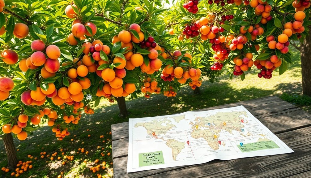
Projects like Falling Fruit have already mapped over 500,000 food sources worldwide, demonstrating the untapped potential in your neighborhood. By joining these efforts, you'll help reduce the staggering food waste in developed countries, where nearly half of all food goes uneaten.
Mapping urban food sources reveals abundance hidden in plain sight while combating the epidemic of waste in our food systems.
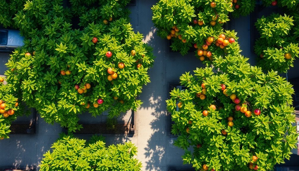
The Guerrilla Grafters initiative offers another approach—grafting fruit-bearing branches onto ornamental trees to increase local food access.
These collaborative activities foster connections among neighbors while promoting sustainable practices and environmental awareness. When you participate in mapping and harvesting local fruit trees, you'll transform overlooked resources into community treasures.
Seasonal Considerations for Fruit Tree Mapping
As you commence on mapping neighborhood fruit trees, understanding seasonal rhythms becomes essential for success. Each season presents unique opportunities for your mapping efforts.
Spring offers prime identification time as trees burst into bloom, making it easier for you to document future fruit-bearing locations.
During summer, focus on mapping ripening fruits when many species reach their peak production.
Fall is harvest season's pinnacle—your chance to catalog late-season fruits and nuts before winter arrives.
Don't overlook winter's value; use this dormant period to assess tree health and plan your mapping strategy for the upcoming year.
Ethical Guidelines for Urban Fruit Harvesting

Before you gather fruit from neighborhood trees, understanding the ethical foundation of urban harvesting guarantees both sustainability and community respect.
Always obtain permission from property owners before picking fruit from private land—this isn't just courteous, it's vital for respecting boundaries.
When harvesting, practice moderation. Leave sufficient fruit for wildlife and future growth cycles. This sustainable approach guarantees trees remain productive season after season.
Educate yourself about proper identification and ripeness indicators to minimize waste and maximize the quality of your harvest. Different fruits have different peak harvesting windows.
Consider partnering with local food banks to share your bounty.
Finally, familiarize yourself with regional foraging regulations, as laws vary by location. Following these guidelines transforms casual picking into responsible community stewardship.
Using Digital Platforms to Document Tree Locations
You'll find interactive mapping platforms like Falling Fruit invaluable for documenting neighborhood fruit trees with precise GPS coordinates and taxonomic details.
Community survey applications enable you to verify existing tree locations and add newly discovered edible plants to the collaborative database of over half a million food sources.
Interactive Mapping Software Tools
The digital revolution has transformed how communities document and share information about neighborhood fruit trees through interactive mapping platforms. These user-friendly tools allow you to tag trees, mark potential grafting candidates, and verify previously reported locations, all while building a searchable database organized by fruit type.
When you participate in our mapping network, you'll experience:
- Connection to abundance – discover hidden fruit sources just blocks from your home
- Community building – meet neighbors who share your passion for local food
- Environmental impact – help reduce food waste by ensuring fruit doesn't fall unused
You can instantly contribute data about trees in your area while accessing information others have shared, creating a dynamic resource that supports sustainable harvesting practices and improves everyone's access to fresh produce.
GPS Tracking Methods
Now that you're familiar with interactive mapping software, let's explore how GPS tracking brings precision to your fruit tree documentation efforts. Using mobile apps and online mapping tools, you'll capture exact geographic coordinates of neighborhood fruit trees with remarkable accuracy.
When you input location data, you're creating valuable records that the entire community can access and update. Platforms like OpenStreetMap allow you to share and visualize this information, strengthening community engagement around urban foraging.
Your GPS tracking contributions help identify underutilized fruit resources, supporting food sustainability initiatives in your neighborhood. The collected data reveals distribution patterns of different fruit species, which we use to plan community harvests, workshops, and educational programs.
Community Survey Applications
Several innovative community survey applications have revolutionized how neighborhoods document local fruit trees. These user-friendly digital platforms allow you to easily report and map fruit trees in your area, creating a valuable community database that everyone can access and contribute to.
By participating in these surveys, you'll help:
- Reduce food waste by identifying underutilized fruit trees that could provide fresh produce to neighbors in need.
- Connect with like-minded individuals through fruit-sharing events and tree planting initiatives announced through the application.
- Transform your neighborhood by informing local environmental education programs and community harvest opportunities.
Your contributions provide critical data that drives sustainable urban agriculture efforts and strengthens community bonds while ensuring neighborhood fruit doesn't go to waste.
Connecting With Property Owners and Permissions
Successful fruit tree mapping begins with respectful engagement with property owners. Before documenting any tree, you'll need permission from those who own the property where the tree grows. This collaboration builds trust and guarantees your mapping efforts have community support.
When approaching owners, clearly explain the benefits of your project—highlighting how mapping promotes local food sources and sustainability in your neighborhood. Establish specific agreements about access times and how the fruit data will be used.
Utilize social media and community forums to connect with property owners efficiently. Share your project's goals through these platforms to reach a wider audience.
Remember to keep owners updated on your mapping progress and how the information benefits everyone involved. This ongoing communication encourages continued participation in your initiative.
From Mapping to Harvesting: Best Practices
Once you've mapped the fruit trees in your neighborhood, you'll need to transform this knowledge into action through responsible harvesting practices.
Utilize community-driven mapping tools to document fruit-bearing trees and contribute to a collective resource that benefits everyone.
Follow these essential practices for successful urban harvesting:
- Implement proper tree stewardship through regular pruning and mulching to guarantee continued health and productivity of your mapped fruit sources.
- Organize community harvest events that bring neighbors together, reducing food waste while strengthening local relationships.
- Explore grafting initiatives like those of the Guerrilla Grafters, which transform ornamental trees into food-producing assets that enhance your neighborhood's food security.
Encourage your neighbors to join the mapping network—together you'll create a more sustainable and connected community.
Contributing Data to Citywide Food Security Initiatives
By mapping your neighborhood's fruit trees, you're not just creating a personal harvest guide—you're contributing essential data that strengthens your city's food security network.
When you share information about local fruit-bearing trees, you help identify valuable food sources for community members facing food insecurity. Your documented locations become part of a larger database that informs local food policies and supports urban agriculture initiatives in underserved areas.
Your participation raises awareness about potential urban harvests and reduces food waste by making fresh produce more accessible. As you catalog these natural resources, you're fostering community collaboration and empowering neighbors to utilize available food effectively.
Every tree you map becomes a point of connection in your city's sustainable food system—a small but significant step toward collective food security.
Training Workshops and Skill Development Opportunities
While mapping fruit trees requires minimal equipment, developing the right identification skills dramatically enhances your effectiveness as a community mapper.
Trees For Houston offers specialized workshops where you'll learn to identify and document fruit-bearing trees throughout our neighborhoods.
You'll gain valuable expertise in:
- Using the Falling Fruit map – Master adding and verifying urban harvest locations to build a thorough community resource
- Grafting techniques – Participate in hands-on sessions with the Guerrilla Grafters Initiative to increase urban fruit availability
- Community engagement strategies – Connect with neighbors while creating meaningful food access resources
We'll provide ongoing support, educational materials, and regular updates as you contribute to this essential urban forestry initiative.
Join us to transform your neighborhood while developing valuable skills!
Frequently Asked Questions
How to Get Fruit Trees for Free?
You can get free fruit trees through Trees For Houston's community giveaway events. Register in advance as supplies are limited. These events are sponsored by organizations like CenterPoint Energy to enhance local neighborhoods.
Which Tree Planting Charity Is Best?
Trees For Houston stands out as an excellent tree planting charity. You'll find meaningful volunteer opportunities, free educational programs, and community events scheduled for March and April 2025. Their inclusive approach benefits diverse Houston neighborhoods.
How to Get Free Trees in Texas?
You can get free trees in Texas through Trees For Houston's community giveaways. Register on their website or social media for upcoming events. They partner with sponsors like CenterPoint Energy to provide trees to residents.
How to Get Involved With Planting Trees?
You can join scheduled planting events on March 21 or April 4, 2025, or participate in bioswale installations on Earth Day. Register by providing your contact details and preferred date. Custom group dates need 25+ volunteers.
In Summary
You're now equipped to make a real difference in your community! By mapping fruit trees, you'll connect neighbors, reduce food waste, and create a more resilient local food system. Don't wait—join our volunteer network today and transform your neighborhood into an accessible urban orchard. Your efforts will help everyone enjoy nature's bounty while building stronger community bonds.


Leave a Reply