
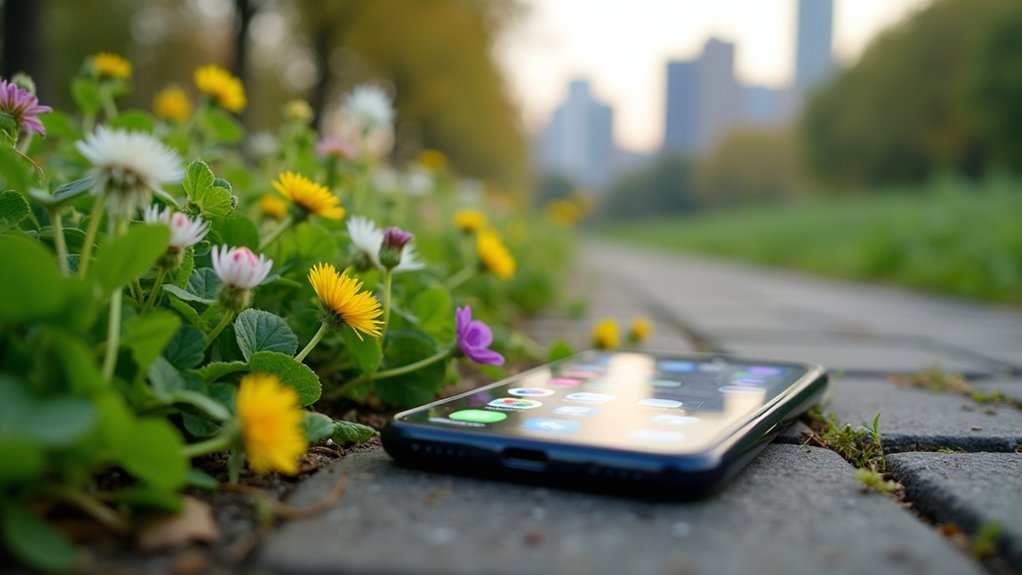
The best foraging apps combine accurate GPS tracking, offline maps, and plant identification tools tailored for urban environments. PictureThis offers 78% identification accuracy while PlantSnap covers 600,000+ species. Look for apps with harvest timing alerts, community sharing platforms, and strong privacy controls that let you obscure exact locations. Cross-platform synchronization keeps your valuable spots accessible across all devices. The right app transforms how you find, document, and sustainably collect edible plants in your city.
GPS Accuracy for Urban Foraging Environments
While urban foraging enthusiasts increasingly rely on GPS technology to locate and remember valuable harvest sites, the concrete jungle presents unique challenges for accurate positioning.
Tall buildings create multipath errors and signal occlusion, potentially throwing off your location by 10-20 meters.
Your smartphone's GPS typically performs worse than dedicated GPS units due to smaller antennas. When foraging in areas with dense tree canopies, expect accuracy to decrease further—potentially up to 11 meters off under closed canopies. Research comparing different GPS systems found an average error of 7 meters in location estimation when monitoring animal movement patterns.
To improve accuracy, look for apps that incorporate map-matching algorithms and A-GPS technology. These features align your position with known map features and use cellular networks to enhance positioning.
Consider how the app handles seasonal variations too, as foliage density changes throughout the year can impact signal reception.
Offline Mapping Capabilities for City Expeditions
As urban foragers venture deeper into concrete landscapes with unreliable cell coverage, offline mapping capabilities become essential for successful expeditions.
Both iOS and Android users can download city maps beforehand through apps like Gaia GPS and Forager's Buddy.
You'll benefit from GPS technology that works independently of internet connectivity, allowing real-time location tracking even in signal dead zones.
These apps let you mark remarkable spots and save custom locations as you discover urban bounties. Most importantly, your collected data—including photos and waypoints—can be synced to cloud accounts once you're back online.
For extended city foraging trips, consider downloading maps at lower resolution to conserve phone storage and battery life, ensuring you can document your entire expedition without technical limitations. Apps typically offer detail level options ranging from low to high, with lower detail covering more area while higher detail provides greater clarity for specific locations.
Seasonal Growth Tracking Features

Modern foraging apps integrate growth calendars that show you exactly when local edibles emerge throughout the year.
You'll receive seasonal spot reminders that notify you when previously discovered patches are ready for a return visit.
The harvest timing alerts help you maximize your haul by prompting you to collect plants at their peak ripeness, ensuring perfect flavor and nutrition. Many apps also include a seasonal availability database that helps foragers track when specific wild foods are at their optimal harvesting times throughout the year.
Growth Calendar Integration
Successful foraging relies on precise timing, making growth calendar integration a game-changing feature in foraging apps. The best apps track essential data points like plant species, growth stages, and environmental conditions through an intuitive interface that simplifies recording your observations. Many top foraging apps offer personalized notifications to ensure you never miss optimal harvesting periods.
You'll benefit from customizable tracking options for different plants and locations, while real-time updates keep you informed about ideal harvesting times. Advanced analytics help you understand growth patterns and plan more effective foraging trips.
Many apps leverage calendar API integration for cross-platform compatibility and seamless synchronization. Look for apps with thorough, regularly updated plant databases that allow user contributions to enhance accuracy.
The most effective implementations include robust search functions and data validation processes to guarantee you're working with reliable information when planning your next foraging adventure.
Seasonal Spot Reminders
Seasonal spot reminders transform casual foraging into a reliable food-sourcing strategy by leveraging technology to track wild edibles throughout their growth cycles. These smart features notify you when plants reach peak harvesting times based on your location's specific growing conditions. Effective foraging apps utilize ecosystem service mapping to visualize the spatial distribution of edible species across different landscapes.
| App Feature | User Benefit | Real-World Application |
|---|---|---|
| GPS-Enabled Alerts | Notifications when nearby plants are ready | Get alerted when morels emerge in your area |
| Seasonal Databases | Access to extensive harvest calendars | Plan trips around peak ramp harvesting season |
| Community Reports | Real-time updates from local foragers | Learn when others found chanterelles nearby |
| Custom Reminders | Set alerts for your favorite species | Never miss elderberry season again |
| Location-Specific Data | Information tailored to your region | Discover which plants thrive in your climate |
With these tools, you'll maximize harvests by arriving at the perfect moment when plants are abundant and at their nutritional peak.
Harvest Timing Alerts
While seasonal spot reminders provide a broad overview of foraging opportunities, harvest timing alerts deliver precision-focused notifications that can make the difference between a bountiful haul and going home empty-handed.
These sophisticated features track seasonal growth patterns and use data-driven insights to notify you exactly when specific species are ready for harvesting. Setting up these alerts follows a similar process to mobile apps where users must navigate to the account tab and enable notifications.
- Location-specific alerts adjust timing based on your region's climate and growing conditions
- Species-specific notifications guarantee you only harvest plants at their peak ripeness
- Real-time weather integration helps apps recalculate ideal harvesting windows during unusual weather patterns
- Sustainability guidance accompanies alerts to promote responsible foraging practices
The most advanced apps combine algorithmic analysis with community contributions, creating increasingly accurate predictions while allowing offline functionality for remote foraging expeditions.
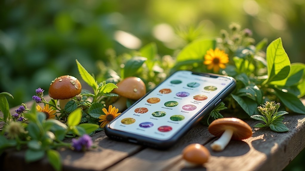
Plant Identification Tool Comparison

When comparing plant identification tools, you'll find significant variations in real-time recognition accuracy, with PictureThis leading at 78% correct identifications compared to Plant.net's 68%.
The size of a foraging app's plant database directly impacts its usefulness, with extensive options like PlantSnap covering endangered species alongside common edibles.
Several apps now offer offline identification capabilities, which you'll appreciate in remote foraging locations where cellular service is unavailable. Experts strongly recommend against relying solely on these apps for identifying plants when foraging for consumption.
Real-time Recognition Accuracy
As foragers venture into the field, the accuracy of plant identification tools becomes critical for both safety and success. Plant ID apps vary considerably in their recognition capabilities, with PictureThis offering the most consistent high accuracy (59-90%), while PlantSnap lags behind competitors despite its extensive database.
When selecting a foraging app, consider these key accuracy factors:
- Community verification – Apps like iNaturalist (92.3% genus-level accuracy) leverage crowdsourced validation to enhance results.
- Environmental conditions – Lighting and background can dramatically affect recognition performance.
- Database quality – More thorough plant libraries yield better identification outcomes.
- Technical parameters – Photo resolution and algorithm sophistication directly impact identification reliability.
- Offline functionality – Apps with offline capabilities allow identification in remote foraging locations without cell service.
For critical identifications involving potentially toxic species, expert validation remains essential regardless of app accuracy.
Plant Database Size
The robustness of plant database size directly impacts identification accuracy in foraging apps. When choosing your foraging companion, consider both the breadth and depth of species coverage. Apps like "Foraging with the Wildman" excel with extensive regional databases, making them invaluable for local plant hunting. Taking clear, well-lit photos of plants significantly improves the identification success rate across all plant identification apps.
| App Name | Database Size | Specialty Focus |
|---|---|---|
| PlantNet | 20,000+ species | Global coverage |
| Wildman | 5,000+ species | Regional edibles |
| PlantSnap | 600,000+ species | All-encompassing |
While general apps offer wider coverage, specialized databases provide deeper insights into edible versus toxic species in your area. The quality of image libraries also matters—apps with multiple photos per species from different angles and growth stages will help you identify plants with greater confidence during your foraging adventures.
Offline Identification Capabilities
Reliable plant identification becomes critical once you venture beyond cellular coverage, making offline capabilities a must-have feature for serious foragers. Apps like PlantSnap, Pl@ntNet, and Nature ID offer robust offline functionality by downloading compressed plant databases to your device.
- Storage considerations – Offline databases require significant space, so check if your device can accommodate these downloads before heading into remote areas.
- Accuracy trade-offs – Expect slightly reduced accuracy with offline models compared to their online counterparts due to data compression. Pl@ntNet's offline identification quality experiences only minimal quality loss, estimated at a few percent compared to the full server model.
- Update requirements – Remember to periodically connect to update your offline databases for improved identification accuracy.
- Wilderness reliability – For true wilderness foraging, prioritize apps with proven offline performance like PlantSnap for identifying potential edibles regardless of connectivity.
Location Privacy and Security Measures
While foraging apps provide valuable location-based information, they also present significant privacy risks that users must understand. Your location data could be shared with third parties or leaked through breaches, potentially exposing your daily routines and favorite foraging spots. Without proper security measures, location data collected by these apps may enable stalking or surveillance of users.
Look for apps implementing robust privacy protections like LP-Guardian, which obfuscates your precise location while maintaining functionality. Choose apps that only access your location "while using" rather than continuously tracking you in the background.
Regularly review app permissions and disable location services when not actively foraging. The best foraging apps encrypt your data, comply with regulations like GDPR, and offer transparent privacy policies.
Remember that even fitness or nature apps have exposed sensitive location data, so prioritize those with clear commitments to user privacy and security.
Urban Terrain Customization Options
Modern foraging apps have revolutionized urban plant hunting by offering sophisticated terrain customization features tailored specifically to city environments.
Technology has transformed urban foraging, bringing digital precision to the ancient practice of wild food gathering in city landscapes.
You'll find these tools particularly valuable when traversing concrete jungles where edible plants often hide in plain sight.
- Geolocation mapping lets you discover nearby foraging opportunities with precision, showing exactly where urban treasures grow.
- Customizable search filters allow sorting plants by season, edibility, or specific urban locations.
- Community-contributed spots enrich your options as fellow foragers share their discoveries in parks, abandoned lots, and public spaces. Apps like iNaturalist encourage community engagement and shared interest in local natural resources.
- Integration with local regulations helps you identify where foraging is legally permitted, keeping you informed about city ordinances and public land restrictions.
Community Knowledge Sharing Platforms
Foraging enthusiasts have transformed simple plant identification apps into thriving digital communities where knowledge flows freely between beginners and experts alike.
Apps like Foraged and iNaturalist leverage discussion boards and forums where you'll find valuable tips, recipes, and location insights from fellow foragers.
The collaborative nature of these platforms allows you to contribute your own knowledge, creating wiki-like databases that grow more valuable over time.
You'll benefit from crowdsourced identification services where experts verify plant species, enhancing safety and reliability.
Many apps incorporate rating systems so you can gauge the trustworthiness of shared information before heading out.
Location-based sharing features enable you to discover nearby foraging spots contributed by community members, making these apps invaluable resources for expanding your harvesting horizons. Similar to Wikipedia's approach, these platforms maintain neutral point of view while presenting diverse foraging perspectives from different geographic regions.
Harvest Management and Sustainable Foraging Tools
Tracking and managing your harvest effectively becomes essential as you develop your foraging skills, with several apps now offering specialized tools to support sustainable practices.
The Forager Diary app helps you log favorite spots with GPS tracking, allowing you to revisit successful locations and monitor their recovery between harvests. Following the rule of thirds ensures you maintain ecological balance while foraging in natural environments.
- Most foraging apps recommend harvesting no more than 25% of any patch to maintain ecosystem balance.
- Detailed harvest logs help identify seasonal patterns and peak abundance times for different species.
- GPS technology enables precise location tracking, creating a personal map of productive spots.
- While apps provide guidelines, you'll need to manually track quotas as most don't automatically enforce sustainability limits.
Cross-Platform Synchronization for Urban Explorers
Urban explorers who forage across different city environments face a practical challenge—keeping their valuable spot data accessible across all devices.
Cross-platform synchronization addresses this need by ensuring your foraging locations and notes remain consistent whether you're planning on your desktop or maneuvering with your smartphone.
Solutions like Syncthing offer peer-to-peer synchronization without relying on cloud servers, providing real-time updates with enhanced privacy. Unlike typical forage apps, Playapod's syncing approach stores data in secure cloud storage to prevent unauthorized access to your sensitive location information.
If you prefer cloud-based options, Nextcloud and Seafile deliver robust file versioning and collaboration features, though consider potential privacy trade-offs.
When selecting a sync solution, prioritize multi-platform support, customizable sync settings, and strong security features.
The right synchronization tool will transform how you document your urban harvests, allowing seamless collaboration with fellow foragers while maintaining efficient, consistent access to your discovery data across all your devices.
Frequently Asked Questions
Can These Apps Distinguish Between Edible and Poisonous Look-Alike Species?
Yes, apps like PictureThis, Mushroom ID, and Picture Mushroom help you distinguish between look-alikes by matching photos against databases and providing warnings about toxic species, but you shouldn't rely solely on them.
How Do Foraging Apps Handle Restricted or Private Property Boundaries?
Foraging apps use GIS data to show property boundaries with warning systems that alert you when you're approaching private land. You'll receive notifications and visual cues to help prevent accidental trespassing during your plant-hunting adventures.
Are There Features for Recording Weather Conditions Affecting Growth Patterns?
Most foraging apps don't directly record weather conditions affecting growth patterns. You'll find Forager's Buddy Pro offers current weather data, but you'll need to combine it with dedicated weather apps for thorough tracking.
Do Any Apps Alert Users About Potentially Overharvested or Endangered Species?
Most current foraging apps don't alert you about endangered or overharvested species. This is a significant gap in their sustainability features, though iNaturalist indirectly supports conservation through its citizen science approach to species monitoring.
Can I Share Specific Locations With Only Select Foraging Partners?
Yes, you can share specific foraging spots with select partners through Forager's Buddy, which allows location sharing via email or SMS. Other apps offer limited selective sharing capabilities but aren't specifically designed for this purpose.
In Summary
You'll find the perfect urban foraging companion by weighing each app's GPS accuracy, offline capabilities, and plant ID tools against your specific needs. Don't overlook privacy features and community resources as you explore city landscapes. Remember, it's not just about finding nature's bounty—it's about sustainable harvesting and contributing to a growing movement of urban foragers transforming concrete jungles into edible landscapes.

Leave a Reply