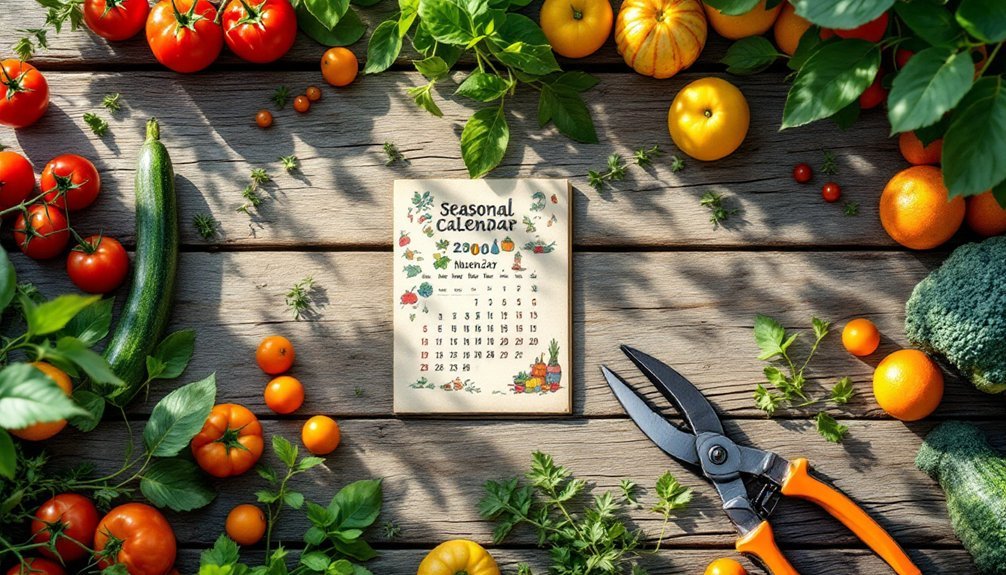
Urban foraging requires more than just knowing what grows—you need to know when it's available. A seasonal calendar helps you track when wild garlic emerges in spring, berries ripen in summer, and nuts fall in autumn. It accounts for microclimate variations that can shift harvest times by weeks and prevents wasted trips. Your personalized harvest map becomes an essential tool for sustainable, efficient foraging that aligns with nature's rhythms rather than supermarket convenience.
The Rhythm of Urban Foraging: Understanding Seasonal Cycles

While supermarkets offer produce year-round, urban foraging connects you to nature's true calendar. Each season reveals distinct edible treasures in your urban landscape, from spring's wild garlic and morels to summer's berries and edible flowers.
You'll discover fall's bounty includes nuts, late berries, and wild root vegetables, with crab apples offering tart fruits that become sweeter after frost.
Winter—often overlooked—provides evergreen needles and winter buds. By tuning into these natural cycles, you'll develop a deeper relationship with your environment.
This rhythmic approach to harvesting isn't just practical—it's sustainable. When you understand seasonal patterns, you'll know when to harvest responsibly, leaving enough for wildlife and avoiding rare species.
Connecting with local foraging communities can enhance your seasonal knowledge, ensuring you're harvesting at peak times for best flavor and nutrition.
Maximizing Your Harvest: Planning With Nature's Timetable
To truly maximize your urban foraging efforts, you'll need to synchronize your activities with nature's precise schedule. Each season offers unique edible plants—wild garlic in spring, berries in summer—and understanding these cycles transforms random gathering into strategic harvesting.
Watch how climate affects plant availability; some edibles actually improve after frost. Equip yourself with proper tools like baskets and knowledge of preservation techniques. Spring brings nutritious options like asparagus and chickweed that can be found in open areas. By freezing summer berries or making syrups from seasonal fruits, you'll extend your harvest's benefits year-round.
Rotate your foraging spots to prevent over-harvesting and maintain ecosystem health. Urban environments host surprising biodiversity—from park edges to abandoned lots.
Mapping Your City's Edible Landscape Throughout the Year

Creating your personalized urban abundance map will help you track neighborhood harvest hotspots that change with each passing season.
You'll discover hidden foraging opportunities as you document when and where specific fruits, vegetables, and edible plants flourish throughout your city. The 2025 Urban Farmers Calendar offers planting and succession schedules that align perfectly with your seasonal mapping efforts.
These seasonal mapping efforts connect you with your environment's natural rhythms while ensuring you never miss peak harvesting times for the diverse edible resources growing right in your community.
Neighborhood Harvest Hotspots
Four essential strategies can transform your neighborhood into a mapped harvest paradise.
Start by adopting a neighborhood-based approach to identify local food availability patterns with greater precision. You'll discover more when you focus on smaller geographic areas.
Implement statistical validation tools like ArcGIS's Find Hot Spots to identify true resource concentrations rather than random occurrences. This helps you target genuine harvest opportunities.
Track seasonal variability in your mapping efforts—remember that availability changes throughout the year, affecting where you'll find abundant resources each season.
Finally, engage local residents in your mapping process. Their participation is vital for validating hotspots and keeping information current. Organizations that involve community stakeholders in creating maps develop lasting community connections that enhance the overall food security initiative.
Community members often know about hidden fruit trees and edible landscapes that aren't documented in official inventories.
Foraging Through Seasons
Mapping your city's edible landscape requires understanding how wild foods emerge and fade throughout the year's natural cycles. As seasons shift, so do your foraging opportunities—spring brings tender greens and shoots, summer delivers abundant berries and fruits, while autumn offers nuts and fungi.
You'll need to adapt your harvesting schedule to your specific region, as timing varies considerably based on local climate conditions. A well-designed seasonal calendar helps you anticipate when each species reaches its prime and prevents you from missing vital harvesting windows. With tools like the Interactive Foragers Calendar, you can easily identify and track wild food availability without years of trial and error.
Remember to forage responsibly by taking only what you need and leaving plenty for wildlife and ecosystem sustainability.
Many experienced urban harvesters mark their calendars with both peak seasons and conservation notes to guarantee they're practicing sustainable collection techniques throughout the year.
Urban Abundance Maps
The foundation of successful urban foraging lies in detailed abundance maps that document exactly where edible species grow throughout your city. These living resources transform with the seasons, requiring regular updates to remain valuable.
Today's technology makes creating these maps easier than ever. You can use GIS tools and mobile apps to precisely mark locations, while community involvement guarantees maps stay accurate and thorough. By engaging in citizen science projects, you'll contribute to a collective knowledge base that benefits everyone.
Your urban abundance map does more than just locate food—it reduces your carbon footprint, increases food security, and fosters community connections.
When you understand what grows where and when, you'll harvest smarter throughout the year, working around seasonal changes and maximizing your foraging potential.
From Blossoms to Bounty: Tracking Urban Fruit Ripening Patterns

Understanding your neighborhood's fruit ripening timeline helps you pinpoint the perfect harvest moments for each species throughout the urban landscape.
You'll want to create a detailed map that identifies where specific fruits grow in your community and when they'll likely reach peak ripeness.
Microclimates within your city—areas affected by buildings, water bodies, or elevation—can accelerate or delay ripening by up to two weeks compared to surrounding regions.
Pay special attention to whether fruits in your area are climacteric or non-climacteric, as this determines whether they continue ripening after being picked or need to be harvested at full maturity.
Ripening Timeline Essentials
Successful urban harvesting relies on understanding the complex patterns that govern fruit ripening across seasons.
You'll need to know both climacteric fruits (like apples and peaches) that continue ripening after picking, and non-climacteric fruits (like strawberries and citrus) that must be harvested at peak ripeness.
Benchmark varieties offer critical reference points: McIntosh apples, Redhaven peaches, and Stanley plums help you track when related varieties will mature. Some apple varieties like Yellow Transparent ripen very early, appearing about 49 days before McIntosh in most regions.
Weather greatly affects ripening schedules—expect variations year to year and across neighborhoods.
Most tree fruits follow predictable patterns: cherries (late June-August), apricots (late July), peaches (mid-August-October), and apples/pears (late summer through early winter).
Neighborhood Harvest Mapping
Now that you understand ripening timelines, turning this knowledge into actionable harvests requires mapping your neighborhood's bounty.
Interactive online platforms like Falling Fruit integrate Google Maps to help you locate edible plants and trees within walking distance.
You'll find many fruit trees growing on or over public property offer free harvesting opportunities. These community-sourced maps combine data from cities, universities, and individual contributors to create thorough inventories of urban food sources.
As you explore these resources, you'll discover seasonal availability patterns specific to your area. In places like Los Angeles, you'll find foraging opportunities year-round. The map displays orange circles that indicate clusters of potential foraging spots in your vicinity.
The best part? This urban bounty is often organic and requires no transportation.
Remember to respect property boundaries and consider ethical sharing practices when using these tools to plan your harvesting calendar.
Microclimate Ripening Effects
While mapping neighborhood resources identifies what's available, microclimate conditions determine when your urban harvest will actually ripen. The same fruit variety can mature weeks apart depending on its microclimate exposure. A south-facing wall that absorbs solar energy during the day and releases it at night can accelerate ripening and extend your growing season considerably.
You'll notice fruits on the same tree ripening unevenly—those facing reflective surfaces or protected from wind will mature faster. In your urban harvest calendar, note these variations. Earlier ripening patterns emerging across numerous urban fruit species can be attributed to the rising global temperatures affecting plant phenology worldwide.
Trees planted against thermal-mass structures might produce earlier harvests than their counterparts in open spaces. As climate change intensifies temperature fluctuations, these microclimate effects become even more pronounced.
Community-Based Harvesting: Coordinating Efforts With Seasonal Guides
When communities come together to harvest urban produce, they create powerful systems that benefit everyone involved. By implementing CSA models, you'll share both the bounty and the risk, ensuring financial stability for local growers while accessing fresh seasonal foods. With share prices typically ranging from $400-$700 annually, members receive weekly deliveries of freshly harvested produce throughout the growing season.
Effective coordination hinges on well-designed seasonal guides that track planting cycles and harvesting windows. You'll find that succession planting through these calendars provides continuous yield throughout growing seasons.
Use collaborative platforms and regular newsletters to keep members informed about upcoming harvests and events.
Don't underestimate the value of community workshops and feedback sessions. These gatherings strengthen relationships while improving your collective knowledge of storage, preservation, and seasonal cooking techniques—turning urban harvesting from a solitary activity into a neighborhood-sustaining endeavor.
Building Resilience: Adapting Your Foraging Calendar to Urban Microclimates
Urban environments present unique foraging challenges due to their diverse microclimates—pockets of varying temperature, moisture, and growing conditions created by buildings, pavement, and scattered green spaces.
Plants in your city may ripen weeks apart depending on sun exposure and heat retention of surrounding structures.
To build resilience into your foraging calendar, track phenological markers rather than relying solely on dates. Notice when certain plants flower or fruit in different neighborhoods. Developing a deep understanding of local flora is more valuable than attempting extensive foraging across unfamiliar territories.
Incorporate local weather data and update your calendar regularly based on your observations.
Create microclimate maps of your foraging areas, noting which spots warm earlier in spring or stay cooler in summer.
You'll soon discover that understanding these urban variations transforms unpredictable harvesting into a more reliable seasonal practice, even as climate patterns shift.
Frequently Asked Questions
Can Seasonal Calendars Help Identify Potentially Toxic Urban Plants?
Yes, you'll find seasonal calendars invaluable for identifying toxic plants by tracking growth phases, highlighting danger periods, and showing distinguishing features that change throughout the year, helping you avoid poisonous lookalikes when foraging.
How Do I Track Invasive Edible Species Through Seasonal Calendars?
You'll track invasive edibles by creating calendars that mark their growth cycles, flowering periods, and fruiting times. Note when they're most abundant and edible while documenting their movement patterns across seasons.
Are Digital or Physical Seasonal Calendars More Effective for Urban Harvesting?
Digital calendars offer automatic reminders and easy updates, while physical ones provide tactile learning without tech dependency. You'll find they're both effective for urban harvesting—choose based on your personal learning style and accessibility needs.
How Do Seasonal Calendars Account for Pollution Exposure in Urban Produce?
Seasonal calendars help you track pollution peaks, allowing you to schedule harvests during cleaner air periods. They'll guide your planting choices and highlight when to implement protective measures for your urban crops.
Can Seasonal Calendars Help Predict Future Climate Impacts on Urban Foraging?
Yes, seasonal calendars can help you predict climate impacts on urban foraging by tracking historical patterns. You'll notice shifting harvest times, identify vulnerable species, and adapt your practices to changing conditions over successive seasons.
In Summary
You'll find your efforts multiplied tenfold once you've embraced a seasonal calendar for urban harvesting. It's not just about knowing what grows when, but connecting deeply with your city's natural rhythms. Start small, adapt often, and watch as your knowledge compounds year after year. Soon you'll move confidently through urban spaces, recognizing nature's bounty hiding in plain sight—right when it's at its peak.


Leave a Reply